

Best Affordable RTK GPS for Excavation Contractors: $3K vs. $40K Systems


For years, many excavation contractors have assumed centimeter-level RTK GPS meant spending $30,000 to $40,000 on a traditional Trimble- or Topcon-type survey system.
That is no longer the only option.
If you’re working inside a supported RTK correction-network area, a practical Emlid RTK GPS rover setup can come in at around $3,000. If you need your own independent base-and-rover system, a complete Emlid setup with the required field equipment can come in at roughly $11,000, depending on configuration.
Compare that with some traditional high-end base-and-rover systems that can approach $40,000 once hardware, software, accessories, and support are included.
For excavation, grading, civil construction, and landscaping contractors, that changes the conversation completely.
The question is no longer:
“Can I afford RTK GPS?”
It is:
“Which RTK GPS setup actually fits the work my crew does?”

What Is RTK GPS for Excavation Contractors?
RTK stands for Real-Time Kinematic.
It uses correction data to improve normal satellite positioning from meter-level accuracy down to the centimeter level under suitable field conditions.
Technically, today’s receivers are GNSS receivers because they can use multiple satellite constellations.
But most contractors simply call it GPS.
That is why we generally use the term RTK GPS when talking about construction workflows.
For contractors, the terminology matters less than what the system allows your crew to do in the field.
RTK GPS can be used for:
Construction layout
Excavation limits
Grade checking
Subgrade verification
Finished-grade checks
Cut/fill verification
Utility layout
Site pickups
Existing-condition measurements
As-built collection
Quality-control checks
Collecting field information for designers
The objective is simple:
Know where you are, know your elevation, and know whether the work matches the design.
RTK GPS does not replace a licensed surveyor where a licensed survey is legally required. It gives contractors a practical way to handle many routine positioning and verification tasks themselves.

Why RTK GPS Has Historically Been So Expensive
Traditional construction and survey GPS systems from companies such as Trimble and Topcon are extremely capable systems.
They can include:
High-end GNSS receivers
Dedicated data collectors
Survey and construction software
Base radios
Accessories
Support agreements
Cloud services
Specialized workflows
Depending on the package, a complete professional base-and-rover system can reach into the tens of thousands of dollars, with some configurations approaching $40,000.
For a large survey company or major contractor, that investment may make sense.
For a smaller excavation contractor who mainly wants to check grade, lay out work, collect as-builts, and verify excavation limits, it can be difficult to justify.
That is where lower-cost RTK GPS systems have changed the market.

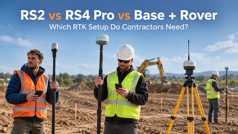
Option 1: Emlid RX2 — Around $3K to Get Into RTK GPS
For contractors working inside a supported RTK correction-network area, the Emlid RX2 is one of the simplest ways to get started.
Instead of purchasing your own base station, the rover can receive RTK corrections through an internet-based correction service.
That means a contractor can potentially get into a practical RTK GPS workflow for around $3,000, depending on the package and service area.
A typical setup may include:
Emlid RX2 rover
Survey pole
Phone running Emlid Flow
RTK correction-network access
The RX2 is well suited for:
Grade checks
Construction layout
Excavation limits
Site pickups
Cut/fill checks
Elevation verification
As-built collection
One major advantage is that your phone acts as the data collector through Emlid Flow.
That eliminates the need for a separate expensive survey controller for many contractor workflows.
For a small excavation or grading company, that can make RTK GPS much easier to justify.

Option 2: Emlid RS4 Pro — More Capability for Daily Production Use
The Emlid RS4 Pro is a stronger option for contractors who expect RTK GPS to become part of their everyday field workflow.
It offers more advanced field capability, including tilt compensation, which can make collecting or laying out points easier when keeping the survey pole perfectly vertical is difficult.
That can be useful around:
Excavations
Structures
Utilities
Slopes
Obstructions
Active construction areas
The RS4 Pro is a good fit for contractors regularly performing:
Construction layout
Earthworks verification
Grade checks
Utility work
Site control
As-built collection
More complex field measurements
The RX2 is an excellent entry point.
The RS4 Pro is better suited to crews that expect to use RTK GPS as a regular production tool.

Option 3: Emlid Base + Rover — Around $11K for an Independent System
Network corrections are convenient, but they are not available everywhere.
If you work in a remote area, outside a supported correction-network service area, or simply want to control your own correction source, a base-and-rover system may make more sense.
One receiver is established as the base.
The second receiver is used as the rover.
A complete Emlid contractor base-and-rover setup with the required field equipment can come in at roughly $11,000, depending on configuration.
That can be useful for:
Remote earthworks
Rural construction
Mining projects
Large civil sites
Projects with poor cellular service
Areas without an available RTK correction network
You are no longer depending entirely on a third-party correction service.
And even at roughly $11,000, that is still dramatically different from a traditional professional system costing several times more.
$3K vs. $11K vs. $40K: What Are You Actually Paying For?
The important thing is not simply comparing prices.
You need to compare the workflow you actually require.
Around $3,000
A network-connected Emlid rover setup can make sense if:
RTK network coverage is available
You have cellular data
You mainly need layout, grade checks, pickups, and as-builts
You do not need your own base station
Around $11,000
An Emlid base-and-rover setup can make sense if:
You work outside correction-network coverage
You want your own correction source
You work on remote projects
You want an independent RTK system
Up to roughly $40,000
A traditional high-end professional system may make sense if:
You require specialized survey workflows
Your organization is already standardized on that platform
You require advanced software integrations
You need specific enterprise support or hardware capabilities
There is no reason to buy the most expensive system simply because it exists.
Start with the job. Then choose the equipment.
How RTK GPS Fits Into Real Excavation Work
Construction Layout
A contractor can load project information into the field and use RTK GPS to locate:
Corners
Structures
Utilities
Excavation boundaries
Offset points
Design features
Instead of relying entirely on tape measures and offsets, the crew can navigate directly to known project coordinates.
Grade Checking
Grade checking is one of the most practical contractor uses for RTK GPS.
A crew can walk the site and compare measured elevations against the required design elevation.
This can help with:
Subgrade
Gravel
Finished grade
Roadwork
Pads
Trenches
Excavations
The contractor gets immediate field information instead of waiting until later to discover that something is high or low.

Cut and Fill Verification
RTK GPS allows contractors to compare actual ground elevations against design information.
That helps answer questions such as:
How much more needs to come out?
Are we at subgrade?
Is this area still high?
Did we over-excavate?
Are we ready for the next layer?
For earthworks crews, those are everyday production questions.
Site Pickups
A contractor can also collect existing conditions before or during construction.
That information can be sent to a designer or survey professional and used to create:
Surfaces
DXF files
LandXML files
Updated designs
Quantity information
A simple workflow can look like this:
Pick up the site → send the data to design → receive the design back → lay it out → verify construction.
As-Builts
RTK GPS can also help document completed work.
Crews can collect:
Installed utilities
Structure locations
Elevations
Finished surfaces
Project features
That creates a digital field record of what was actually constructed.

RTK GPS + 3D Scanning: The Next Step
Construction crews already spend a significant amount of time taking progress photographs.
The next step is capturing the project as a measurable 3D record.
Using Emlid RTK GPS together with DOT3D scanning workflows, contractors can capture georeferenced 3D information from the jobsite.
Potential applications include:
Progress documentation
Existing conditions
Excavation documentation
Stockpile measurements
Quantity verification
As-built documentation
Quality control
Communication with designers
Client records
Instead of having dozens of disconnected photos, you can begin building a spatial record of the project.
In many situations, crews are already walking the site taking photographs.
Capturing a 3D model can turn that same documentation effort into something that can also be measured, reviewed, and compared later.
The workflow becomes:
Scan → Measure → Design → Layout → Verify
Do Contractors Need to Become Surveyors?
No.
That is not the objective.
The objective is to give contractors better information in the field.
There will always be situations where a professional surveyor is required.
But there are also hundreds of routine measurements, grade checks, pickups, and layout tasks occurring between survey visits.
RTK GPS gives contractors another tool to manage those tasks themselves.
Which RTK GPS Setup Is Right for Your Crew?
A simple way to look at it:
Choose the Emlid RX2 if:
You want an affordable and straightforward RTK rover for:
Layout
Grade checks
Site pickups
As-builts
Excavation verification
and you have access to an RTK correction network.
Choose the Emlid RS4 Pro if:
You expect RTK GPS to become a regular production tool and want additional field capability for more demanding construction workflows.
Choose a Base + Rover setup if:
You work outside correction-network coverage, operate remotely, or want to run your own RTK corrections.
Start With the Job — Not the Gear
One of the biggest mistakes contractors make with technology is buying equipment before deciding exactly how it will be used.
Before choosing an RTK GPS system, ask:
What are we building?
What do we currently call a surveyor for?
Do we need layout?
Do we need grade checks?
Do we need cut/fill verification?
Are we working from DXF or LandXML?
Do we have correction-network coverage?
Do we work remotely?
Do we want to capture 3D site conditions?
Does the crew need training?
Once those questions are answered, choosing the system becomes much easier.
Brogan Group: RTK GPS Built Around Contractor Workflows
Brogan Group works with contractors who want practical field technology without unnecessary complexity.
We supply:
Emlid RTK GPS equipment
RX2 contractor systems
RS4 Pro contractor systems
Base-and-rover RTK systems
RTK correction solutions
DOT3D 3D scanning
Remote training
Workflow implementation support
Our focus is not simply selling equipment.
It is helping contractors determine what equipment actually fits the work they perform.
If you are trying to decide between an RX2, RS4 Pro, or base-and-rover system, bring us your actual project and workflow.
Visit Brogan Group at brogangroup.ca or join the Brogan Group Roundtable to discuss your application.
The goal is not to sell you the most expensive RTK GPS system.
The goal is to get your crew the simplest system that does the job.


Comments