RTK GPS for Contractors: Layout, Grade Checks & As-Builts Without a $40,000 System
Survey-Grade RTK GPS Isn't Just for Survey Crews Anymore
For years, many excavation, landscaping, utility, civil and sitework contractors assumed that getting centimeter-level GPS capability meant spending $30,000–$40,000 or more on a traditional survey-grade GNSS system, specialized data collectors, software and training.
That is no longer the only option.
Modern RTK GNSS systems such as Emlid allow contractors to bring many everyday positioning tasks in-house at a fraction of the traditional entry cost. Crews can use RTK for construction layout, checking grades and elevations, collecting existing conditions, recording as-builts, measuring site features and verifying work before equipment or crews move on.
The goal isn't to eliminate professional surveyors. Boundary work, certified surveys and work requiring professional sign-off still belong with the appropriate licensed professionals.
The opportunity is to reduce the repeated waiting and mobilization associated with routine construction layout and field verification.
Instead of calling a surveyor every time a crew needs another point, elevation or grade check, RTK can put many of those everyday tools directly into the hands of the people building the project.
At Brogan Group, we focus on the entire contractor workflow—not simply selling a GNSS receiver and shipping a box. That includes helping contractors select the right equipment, determine the right correction method, train their crews and implement the technology on real construction projects.
What Can a Contractor Actually Do With RTK GPS?
RTK GPS gives contractors the ability to perform many everyday field tasks without waiting for repeated survey visits.
Instead of treating GNSS as specialized equipment that only a survey crew can operate, modern systems can become another production tool used by the foreman, superintendent or field crew.
Common contractor applications include:
Construction layout and stakeout — locate design points, lines and features directly in the field.
Grade and elevation checks — verify excavation depths, subgrade, finished grades and elevations while the work is happening.
Existing-condition pickup — collect accurate site points before design or construction begins.
As-built documentation — record installed utilities, structures, grades and other completed work before it gets covered.
Cut/fill and quantity workflows — capture field information that can be used for earthwork and material calculations.
Quality control — independently check that work is being built where and at the elevation it is supposed to be.
Design-to-field layout — receive properly prepared DXF, CSV or LandXML project information and bring it back into the field for construction layout.
The biggest advantage isn't simply replacing individual survey visits. It's speed of information.
When a foreman can check an elevation, verify a point or collect an as-built while the crew and equipment are already there, decisions can be made immediately. That can reduce downtime, repeat mobilizations and rework.
Why Doesn't Contractor RTK Have to Cost $40,000?
Traditional professional GNSS systems from brands such as Trimble, Leica and Topcon can represent a significant investment once receivers, dedicated data collectors, software, subscriptions and the complete field ecosystem are considered.
Those systems also offer advanced capabilities that may be important for professional surveyors and specialized applications.
But many contractors don't need every feature of a traditional survey ecosystem just to lay out a project, check grades, collect points or document their work.
That's where systems such as Emlid have changed the equation.
Contractor-ready Emlid RTK setups can start around $3,000, putting centimeter-level RTK positioning within reach of contractors who previously assumed professional GNSS required a $30,000–$40,000 investment.
The lower entry price does not mean Emlid is identical to every premium GNSS system or that more expensive equipment never has a place.
The better question is:
What accuracy, features and workflow does your crew actually need?
If centimeter-level RTK is appropriate for the work, there may be little reason for a contractor to purchase capabilities they will never use.
Emlid RX2 vs. RS4 Pro vs. Base + Rover
There isn't one RTK setup that's right for every contractor.
Emlid RX2 — Simple Contractor RTK
The RX2 is a strong starting point for contractors who want an easy-to-use rover for layout, grade and elevation checks, point collection and as-builts.
When reliable network RTK/NTRIP coverage and cellular data are available, an RX2 rover can operate without the contractor maintaining a local base station.
Emlid RS4 Pro — More Capability for Demanding Field Work
For contractors who regularly work around tree canopy, buildings and other challenging GNSS environments—or who want features such as tilt compensation and camera-assisted workflows—the RS4 Pro provides a more advanced field solution.
The latest RS4-series receivers are designed to perform strongly in challenging GNSS conditions. Actual performance still depends on satellite visibility, multipath, corrections and site conditions, but contractors should not assume professional RTK only works in wide-open fields.
Base + Rover — Your Own Correction Source
If network RTK coverage isn't available, cellular service is unreliable, or a contractor wants an independent local correction source, a base-and-rover setup provides another option.
A local base sends corrections directly to the rover using the appropriate setup, allowing the contractor to operate without depending on a commercial NTRIP network for the correction link.
The objective isn't to sell every contractor the most expensive receiver. It's to match the equipment and correction method to the work the crew actually performs.
Network RTK or Your Own Base Station?
RTK GNSS needs a correction source to achieve centimeter-level positioning.
For contractors, there are two common approaches: network RTK/NTRIP or a local base station.
With network RTK, the rover receives corrections through an internet connection. This can make the field setup extremely simple because the contractor can arrive with a rover, connect to the correction service and begin working without setting up a physical base.
Brogan Group works with Point One Navigation for network RTK corrections.
Contractors considering a network RTK setup can send Jeremy their ZIP code or general working area. Jeremy can review available Point One network information and provide a screenshot showing the base stations in and around their area to help determine whether rover-only RTK makes sense before they purchase.
Reliable cellular or internet service is also important because the rover needs connectivity to receive live NTRIP corrections.
If network coverage isn't available—or the contractor regularly works where cellular service is unreliable—a local base + rover system may be the better solution.
A simple way to think about it is:
Reliable network RTK coverage + reliable cellular data → Rover-only network RTK
No reliable network coverage or unreliable cellular data → Consider a local base + rover
Brogan Group can help determine which approach fits the customer's actual work area before equipment is purchased.
Stop Waiting on Surveyors—Without Replacing Your Surveyor
A major reason contractors invest in RTK GNSS is not to eliminate professional surveyors. It is to reduce how often a production crew has to stop and wait for routine field information.
Crews may need additional layout points, elevation checks, existing-condition pickups, grade verification or as-built information throughout a project.
When every one of those tasks requires another survey mobilization, the cost isn't limited to the survey invoice. Equipment and crews may also be waiting while the information is delivered.
Putting RTK capability in the contractor's hands can allow trained field personnel to perform many appropriate routine construction tasks themselves.
A foreman can check an elevation before continuing excavation. A utility crew can capture an as-built before covering the installation. A landscape contractor can lay out design points. A sitework crew can verify that construction is progressing where it should.
Licensed surveyors remain essential for boundary work, legal surveys, certified control and other work requiring professional certification or sign-off.
The goal isn't contractor versus surveyor.
The goal is to give contractors the tools to handle appropriate day-to-day field work while using professional surveyors where their expertise and certification are required.
Why Emlid Is Easier to Train Across a Crew
One of the biggest differences contractors notice with Emlid is the field interface.
Many traditional survey/GNSS workflows use a separate dedicated data collector or field controller. Emlid Flow can run on a compatible smartphone or tablet, allowing the crew to use a familiar device as the field interface.
That has a major training advantage.
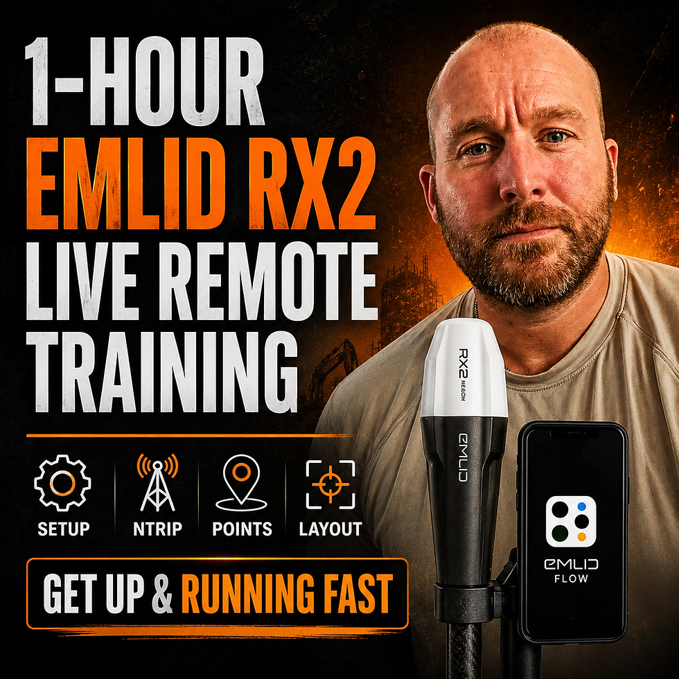
During one-on-one remote training, the contractor can screen-share the same phone or tablet being used with Emlid Flow. Jeremy or a Brogan Group training specialist can see what the crew sees and walk them through the workflow step-by-step.
Training can cover:
RTK and NTRIP setup
Emlid Flow
Point collection
Layout and stakeout
Grades and elevations
As-builts
Importing project data
Base-and-rover workflows
Practical field implementation
The trainer doesn't normally need to travel to the jobsite simply to teach the system.
Some Brogan Group packages include remote training. Additional one-on-one remote training and troubleshooting is available when required.
From Engineer's Drawing to Field Layout
One of the most useful contractor workflows is moving design information from the engineer or designer directly into the field.
When requesting field data, contractors can ask for appropriate DXF, CSV or LandXML information depending on the project and intended workflow.
But file format is only part of the equation.
The coordinate system, units, elevations and project control must also be correct. Simply converting a drawing into DXF does not automatically put it in the right real-world location.
A typical workflow is:
1. Receive properly prepared design data.2. Confirm the coordinate system, units and project control.3. Import the appropriate information into the field workflow.4. Verify the setup against known control.5. Perform layout with the RTK rover.
Brogan Group also provides project-specific setup assistance. Jeremy can help prepare field workflows, organize layers and work with project information so crews see what they actually need in the field.
Project setup services typically start at $200 per project depending on complexity.
Scan → Measure → Design → Layout With DOT3D
RTK doesn't have to stop at individual points.
Contractors can combine Emlid GNSS with DOT3D and a compatible LiDAR-equipped iPhone Pro to create georeferenced 3D site data.
For the iPhone LiDAR workflow, contractors should use an iPhone 12 Pro / 12 Pro Max or newer compatible Pro/Pro Max model equipped with LiDAR.
Each component has a different job:
iPhone Pro LiDAR → captures the physical 3D geometry
DOT3D → scanning, processing, measurements and 3D workflow
Emlid RX2 → RTK GNSS positioning and georeferencing
This can be useful for:
Existing-condition capture
Stockpile scanning
Excavation documentation
Fill and material quantities
Before-and-after scans
As-built documentation
Residential and landscape site capture
Sending site information to designers and engineers
For excavation work, a contractor can capture the site before excavation and again afterward, then use the resulting surfaces/models to help calculate how much material changed or was removed.
For stockpiles and earthworks, quantities can be expressed in practical construction units such as cubic yards or cubic meters, depending on the processing workflow.
Brogan Group describes the overall process simply:
Scan → Measure/Quantify → Design → Layout
What About Machine Guidance?
GNSS can also play a role around construction equipment, but it's important to distinguish grade checking, grade guidance and automatic machine control.
A worker carrying a rover can use RTK to check elevations and grades.
Contractors and DIY users are also mounting compatible GNSS receivers on equipment such as skid steers and dozers to provide grade guidance—giving the operator elevation or grade information while the operator still controls the machine.
That is different from a full automatic 3D machine-control system that interfaces with the machine hydraulics.
Brogan Group can help contractors understand which level of technology fits the machine and application.
Emlid equipment can also be used in certain compatible third-party and machine-control workflows. For example, Brogan Group has demonstrated an Emlid RS4 being used as a base correction source with compatible Trimble machine-control equipment.
Compatibility should always be checked against the customer's exact machine-control hardware and correction method.
When RTK GNSS Isn't Precise Enough
RTK GNSS is extremely useful for contractor applications where centimeter-level positioning is appropriate.
But it isn't the correct tool for every tolerance.
When the work involves very tight building tolerances, anchor bolts, structural steel, embeds, mechanical layout or other precision-critical applications requiring accuracy beyond what GNSS can reliably provide, Brogan Group can move the customer into a Stonex robotic total station workflow.
The important point is that contractors don't have to force one technology into every application.
General contractor RTK and sitework → Emlid GNSS
Higher-precision optical layout → Stonex robotic total station
The goal is to use the right technology for the tolerance the project actually requires.
Brogan Group Doesn't Just Ship the Hardware
Buying the receiver is only one part of successfully implementing RTK.
Brogan Group works with contractors on:
Equipment selection
Network RTK/NTRIP coverage
Base-and-rover systems
One-on-one remote training
Crew implementation
DOT3D scanning workflows
CAD/design-to-field workflows
Project setup
Troubleshooting
Ongoing implementation support
This is intended to be a long-term working relationship—not a hardware transaction where the box arrives and the support disappears.
For contractors who want project-specific assistance, Jeremy provides project setup services typically starting at $200 per project depending on complexity. Ongoing project-support arrangements can also be established where appropriate.
See the Workflows in the Field
Brogan Group has created practical field demonstrations showing many of these workflows in use.
3 Great Reasons to Use GNSS on Your Construction Sitehttps://youtu.be/3GecuRC0R58?si=p309TlKt7IitAUTo
Scanning a Gravel Pile With DOT3Dhttps://youtu.be/yZ-7Zzbs7TA?si=iSE2bUUvb47vdQRJ
Calculating Fill Volumes With DOT3Dhttps://youtu.be/PBdmbEiUwik?si=JGIGjAg4Vl00HOTV
Picking Up Existing Conditions Before Designhttps://youtu.be/-TV0iI_6uPA?si=Cg3WJTI-TjxYuurY
Scanning an Existing Backyardhttps://youtu.be/8J_CnNYUvM8?si=oDMEeMr7JxSuPinK
DIY Grade Guidance for Skid Steers and Dozershttps://youtube.com/shorts/21HGsnFkO44?si=An8nzDs9_TmXuGHY
Emlid RS3 vs. Trimble Field Comparisonhttps://youtu.be/2qkJgoxaK94?si=CaGBHABAcSUmqzEC
No NTRIP Coverage? Using Your Own Basehttps://youtu.be/i1lm9ikv5gc?si=h1vyhzYob_rTEfC5
Importing CAD Drawings Into Emlid Flowhttps://youtu.be/-xOrji1sxZk?si=5IQko_vvlsUEocZY
Emlid Base With Trimble Machine Controlhttps://youtu.be/sZXznB_5Fp8?si=4RUZ6tzMOUghDQh0
Not Sure Which RTK Setup Fits Your Company?
You don't need to figure it out alone.
Jeremy hosts a free Contractor Workflow / GNSS Implementation Session with a small group of contractors. It's designed for contractors who want to understand how RTK, Emlid, NTRIP, scanning and design-to-field workflows can fit into their operation before purchasing equipment.
You can ask questions about your own application, see how the workflow works and determine what equipment actually makes sense for your crew.
If you prefer a private pre-purchase conversation, you can also book a free quick call with Jeremy.
Comments